The junction system
Extensive route planning or cumbersome searches for the right route are a thing of the past: With the new junction system, cycle tours can be planned in an uncomplicated manner and put together according to your own taste.
The routes along a total of 350 junction points marked in red and white in Radregion Rheinland offer both extensive natural surroundings and fabulous panoramas as well as urban flair and cultural diversity. The uniform system throughout the entire region makes orientation easy.
The junction system - what is that?
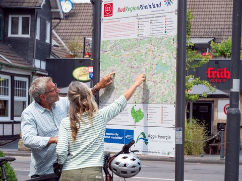
The Radregion Rheinland junction system provides maximum flexibility on a route network of over 3,000 km: the honeycomb junction system had been added to the uniform red and white signage system in use throughout NRW. When routes in this honeycomb system intersect, this represents a "junction point", which is marked by a number encircled in red. At this point, an overview panel shows which route will take you to the next junction point. The junction numbers are also shown in parentheses below the destinations.
How it works - Cycling by numbers
The idea for the junction system came from the Benelux countries, where it has been tried out and proven to be very popular for many years. No wonder, because it makes cycling tours possible without any great preparation beforehand: Simply plan the route according to the map, note the numbers of the respective junction points and off you go!
Along the way, the markings are clearly visible on signposts and boards along the route. The next junction point you will come to is also clearly indicated at each junction point. So you can find your way quite easily and changes during the tour are no problem either! Whether you extend the tour or cut it short, or visit a different sight - you can plan the routes flexibly as required.
Info on the Numbered-Node Cycle Network (Rhineland Cycling Region)